

Nepal UK
This analysis reflects confirmed reporting as of the Kathmandu Post's last updates on 25 September — highways (09:32 NPT), airports (10:55 NPT) and the flood-risk bulletin (12:24 NPT), roughly 8–11 hours before this piece was compiled (20:58 NPT / 16:13 BST). Given the "Breaking" designation, all figures below should be re-verified before publication and refreshed against the same three sources through the day.
A slow-building weather warning has tipped into a nationwide transport crisis: four major highways out of Kathmandu are blocked or restricted, five domestic airports are shut to poor visibility, and meteorologists have placed twelve western districts on high alert for flash flooding — all while the country is still absorbing last month's catastrophic Bhotekoshi-Trishuli floods.
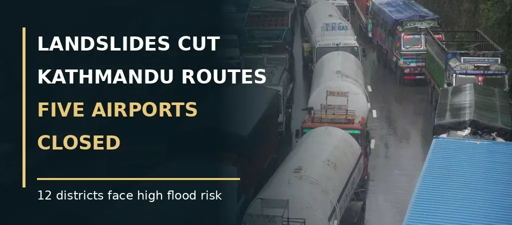
Persistent rainfall linked to a low-pressure system moving across Nepal from the Bay of Bengal has disrupted road and air travel nationwide on 25 September, with landslides blocking or restricting the BP Highway, Prithvi Highway, Narayanghat-Muglin road and Kanti Lokpath, and poor visibility grounding flights at five domestic airports. Nepal's meteorological authorities have simultaneously placed twelve districts in Gandaki, Lumbini, Karnali and Sudurpaschim provinces on high flood-risk alert after a rain gauge at Archale in Palpa recorded 187mm in 24 hours. No new mass-casualty incident had been confirmed as of the most recent reporting, but the scale of simultaneous disruption — road, air and flood risk together — marks a clear escalation from the precautionary overnight closures reported earlier in the week.
What's Actually Blocked
The disruption is concentrated on the arteries connecting Kathmandu to the rest of the country. On the BP Highway, landslides at Charsayabensi and Gimdi in Kavrepalanchok's Roshi Rural Municipality forced an overnight closure from 4:30am, with local Chief District Officer Gopal Kumar Adhikari saying authorities would assess conditions before deciding whether to extend restrictions into daytime hours. The Prithvi Highway — used by more than 14,000 vehicles daily — is affected at seven separate locations in Dhading district alone, with two points (Krishnabhir and Tigraang Khola) completely blocked and five others reduced to single-lane traffic; debris clearing is underway at Krishnabhir but with only two pieces of equipment deployed. The Narayanghat-Muglin road, which normally carries over 10,000 vehicles a day and is one of the principal routes linking Kathmandu to Chitwan and onward to the Tarai, remains closed until further notice. Kanti Lokpath, a key link to Makwanpur and Hetauda, is blocked at three points in Lalitpur. Chitwan CDO Ganesh Aryal confirmed both the Prithvi Highway and Narayanghat-Muglin closures and said restrictions would continue as long as rain persists.
What's Grounded
Poor visibility — measured at roughly 3 kilometres at Kathmandu's Tribhuvan International Airport at 6am and largely unchanged by 10am — has closed Bharatpur, Pokhara, Lukla, Simara and Surkhet airports and pushed flight operations onto Instrument Flight Rules, restricting the Visual Flight Rule services that many mountain routes depend on. Of Friday's 134 scheduled domestic departures — split across Buddha Air (58), Yeti Airlines (27), Shree Airlines (23), Summit Air (10), Tara Air (10), Sita Air (4) and Nepal Airlines (2) — Sita Air cancelled its full schedule outright, while Tara Air and Summit Air delayed operations pending improvement. The airport authority's own advisory warned that further flights "could be cancelled, delayed or rescheduled." Lukla-bound passengers, many of them trekkers and tourists heading into the Everest region during what would normally be peak autumn trekking season, were reported among those experiencing the heaviest delays at Kathmandu.
Where the Flood Risk Is Rising
Nepal's meteorological department has named twelve districts — Gorkha, Lamjung, Kaski, Manang and Mustang in Gandaki; Dang, Banke and Bardiya in Lumbini; Surkhet and Dailekh in Karnali; and Kailali and Kanchanpur in Sudurpaschim — as high-risk for flash flooding over the next two to three days, with the heaviest rain expected in Gandaki, Lumbini, Karnali and Sudurpaschim provinces. Meteorologist Rojan Lamichhane specifically advised suspending rice-harvesting activity in Karnali and Sudurpaschim for several days. A broader band of districts nationwide has been placed at medium flood risk. It is worth noting that Manang and Mustang were already under a separate high-altitude trekking suspension earlier this week, and this new alert extends the safety concern from mountain trails to valley and river settlements.
Why This Matters Beyond a Single Rainy Day
This is happening against a backdrop that makes the stakes unusually high. Nepal is still recovering from the Bhotekoshi-Trishuli floods of 26 August, which killed at least 1,400 people and left over 6,000 missing — the same disaster Prime Minister Balendra Shah invoked at the UN General Assembly this week and which prompted the Asian Development Bank to cut Nepal's growth forecast to 4.1%. A second wave of infrastructure disruption, even without fresh casualties so far, adds further strain to an economy the ADB already flagged as fragile, and to communities whose roads, bridges and embankments may not have been fully repaired since August. There is also a forward-looking dimension for the diaspora specifically: Dashain 2026 runs from 11 to 25 October, with Tika day on 21 October, and millions of Nepalis — including many returning from abroad — will be travelling home on exactly these routes in roughly two and a half weeks. Recurring landslide closures on the Prithvi Highway and Narayanghat-Muglin road this early in the post-monsoon period are a legitimate early warning for anyone planning Dashain travel to build in contingency time, even though today's disruption itself is not part of the festival rush.
What Remains Unconfirmed
No casualties or missing-person reports tied specifically to today's landslides had been published in the sources reviewed, and this should be treated as provisional rather than final given how quickly conditions are changing — NepalUK could not verify whether any casualty figures were released after the most recent updates (09:32–12:24 NPT). The precise reopening timeline for each highway section, and whether airport closures will extend into Saturday, were not stated in any source and should be confirmed against live Department of Roads and Civil Aviation Authority of Nepal updates before publication. This piece should be treated as a snapshot suitable for a rolling live-update format, not a final account.


